Thursday, July 28, 2022

Ancient Shoreline?

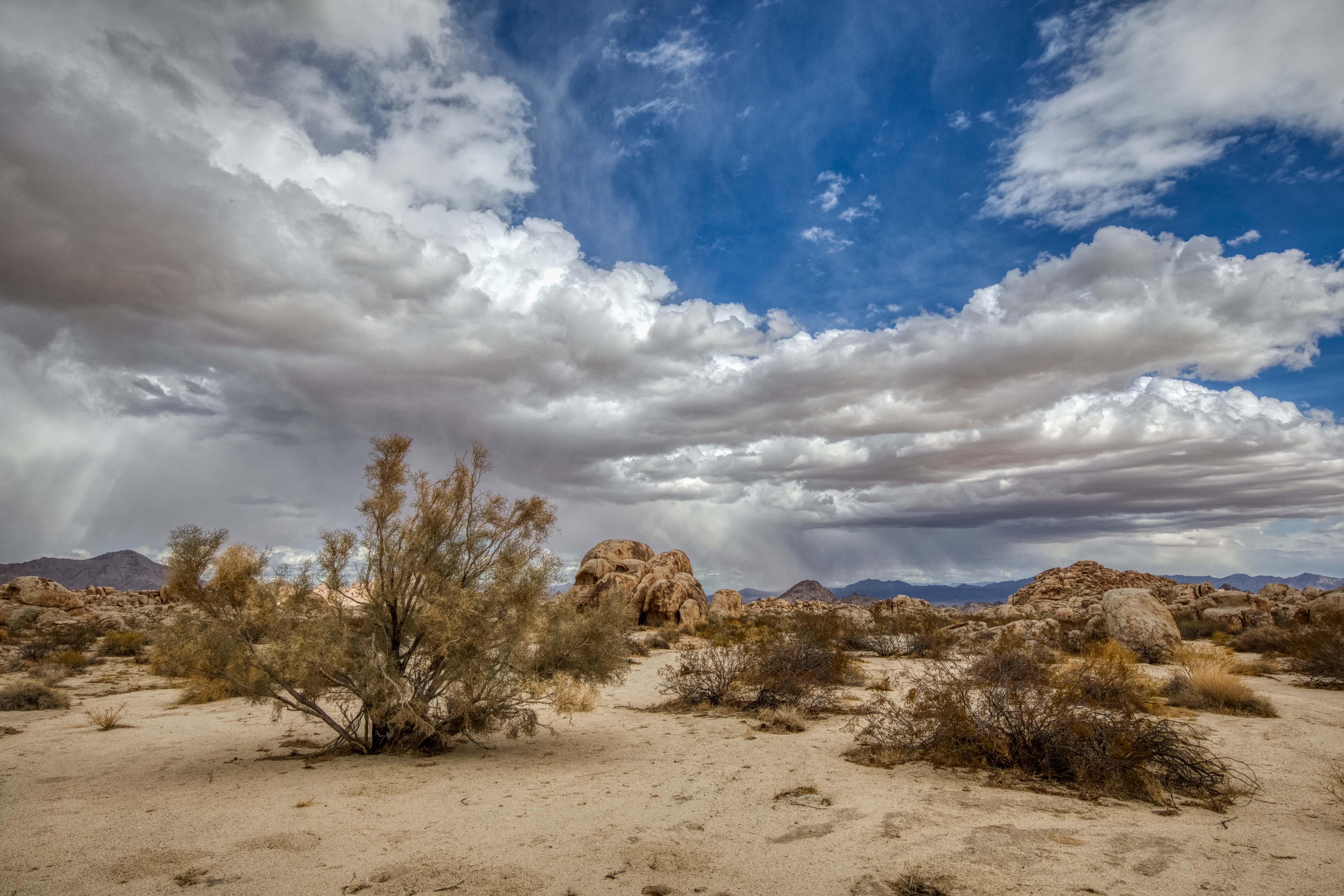
 On my last post I shared the experience of finding something that looks interesting on Google Earth but maybe not as interesting when seeing it at ground level. You just never know. That's OK because you ALWAYS find something interesting in the desert no matter where you hike. Today's hike turned out to be similar: Interesting when viewed from space but meh when viewed from the ground. It's in the same general location as my last hike, but with an excursion further east.

I had discovered an area using Google Earth that looks a little like an ancient shoreline. Who cares about an ancient shoreline, you ask? Good question. Finding ancient shorelines in the Pinto Basin of Joshua Tree National Park has in the past been a productive way of coming across interesting Native American cultural sites going all the way back to the research by the Campbells in the early 20th century. This was a real long shot, but it intrigued me and I figured it was worth checking out. The other plus was I had never hiked to this area (likely not many others have either). 

There's only one problem: I calculated it would be close to 12 miles round trip, which is pushing my upper limit of how far I'm able to hike. Hot weather was a factor too, and I would need to carry a lot of water.
 
**Side note**
If you give me a choice between 12 miles in the open desert (no trail, dodging boulders and cactus, soft sand, climbing in and out of washes, etc.) and 15 miles on a trail going through the forest with similar elevation changes, I'll take the 15 miles any day of the week. Much easier to follow an established trail and far fewer obstructions and detours. I thought about doing an over-nighter and spliting the hike into two 6 mile segments, but decided against it.

So I had two clear goals for this hike:
1] Visit what I called "No Name Arch" in my last hike and see if I could climb up to it, check it out, and get some good photos. By the way, a reader suggested "Elephant Head Arch" and I can see the resemblence, so I'm going with that name. Thank you!!
2] Time and energy permitting, head east to the "Ancient Shoreline" (if that's what it turns out to be) and explore the area.
 
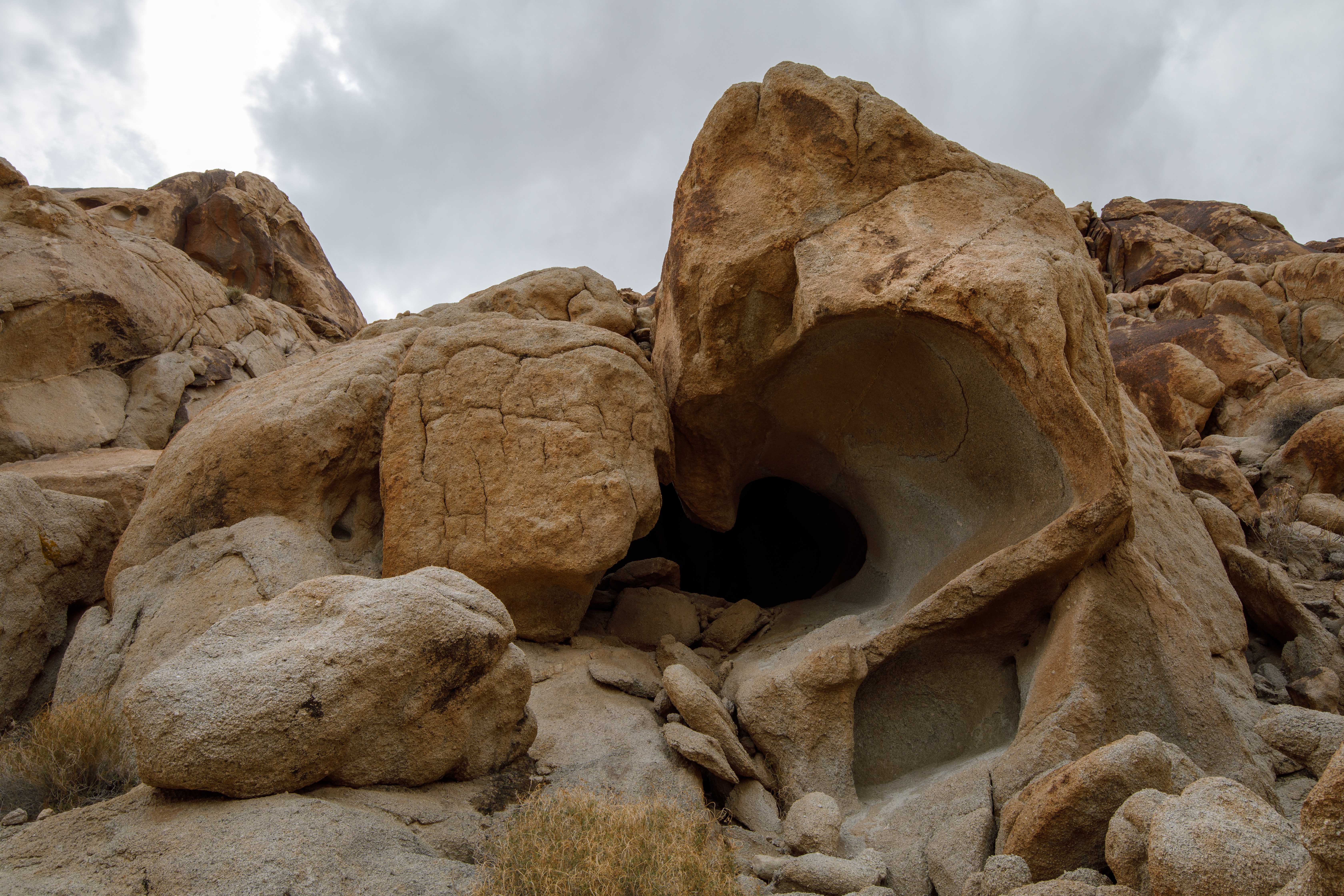
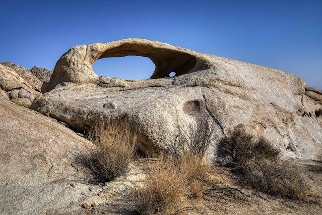
On my way to re-visit Elephant Head Arch, I found another arch! Not too surprising, as there are many interesting arches in this area.
 
There it is... Elephant Head Arch. Hmm, the climb up looks a little more challenging than I recall 😟. Well, let's take it one rock at a time and see how far we can get. 
 
 
I made it! I'd like to try to climb up and get inside the arch and look out the other side, but the granite is steep and smooth. Let's give it a try.
 
Success! This is the view from inside the arch looking east.
 
One last photo of Elephant Head Arch before I start the challenging climb back down. My 4' hiking stick is in the foreground for size perspective.
 
Back down safely off the rocks and in the wash below, I come across a group of tall, spindly plants. I only find these "plants" (they often look like bare dead sticks coming out of the ground) out in NE Joshua Tree. They are usually 6' - 10' tall, and these caught my eye because they are flowering! I think they are some kind of desert milkweed, and you can see flowers and seedpods in the photo above.
 
This tall, stick-like plant actually has pretty flowers, and it's unusual to see them in bloom.
 
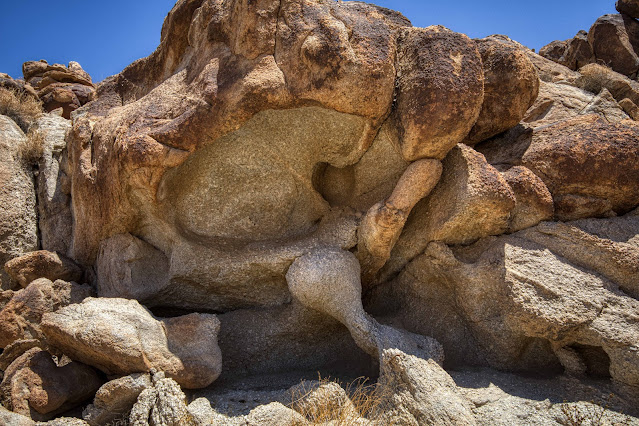
The strange, twisted, tortured rock formations keep me coming back to this area!
 
These desert tortoises have a very tough life indeed. I rarely see living tortoses, but come across their shells (like the one above) on a regular basis. Kind of sad.
 
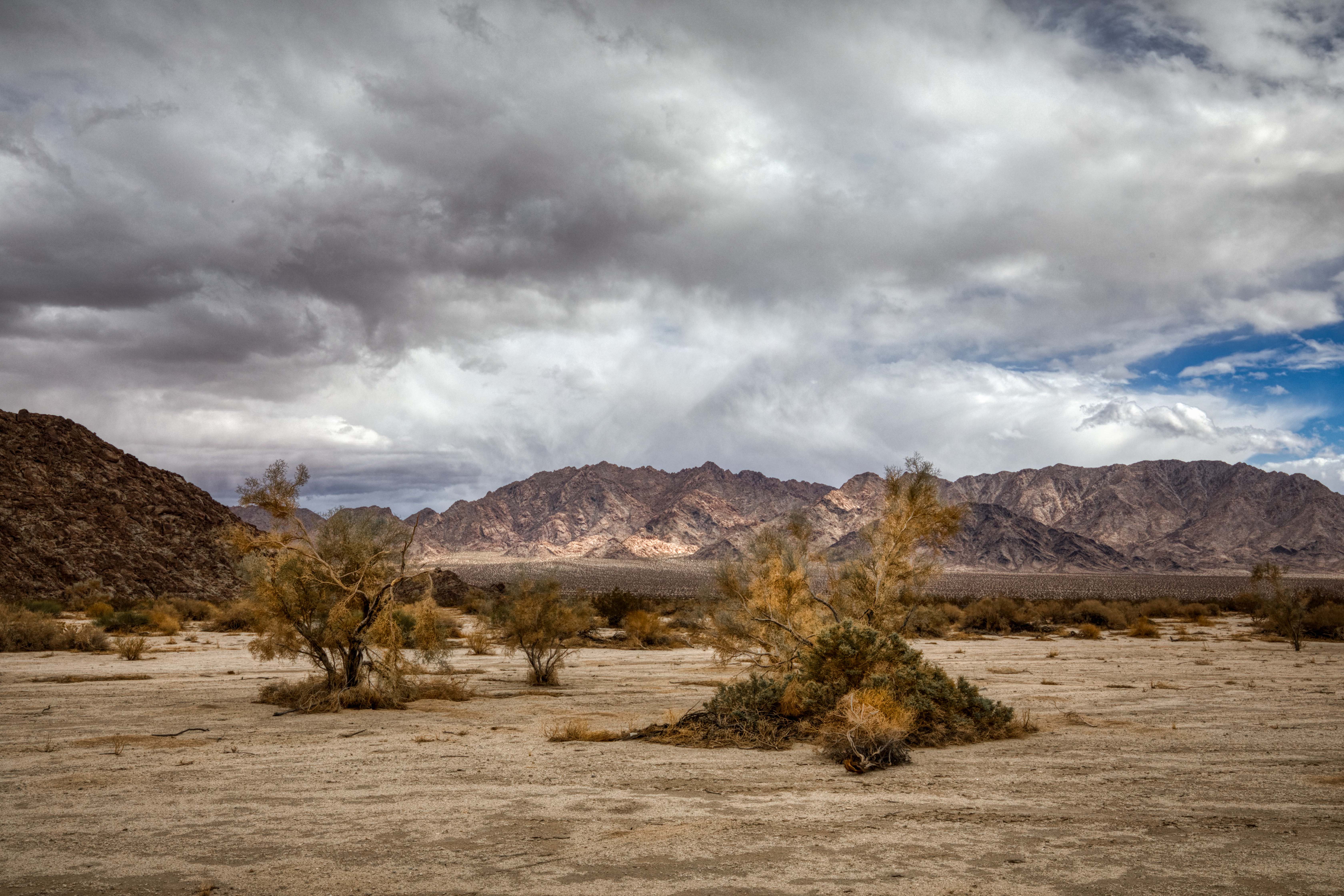
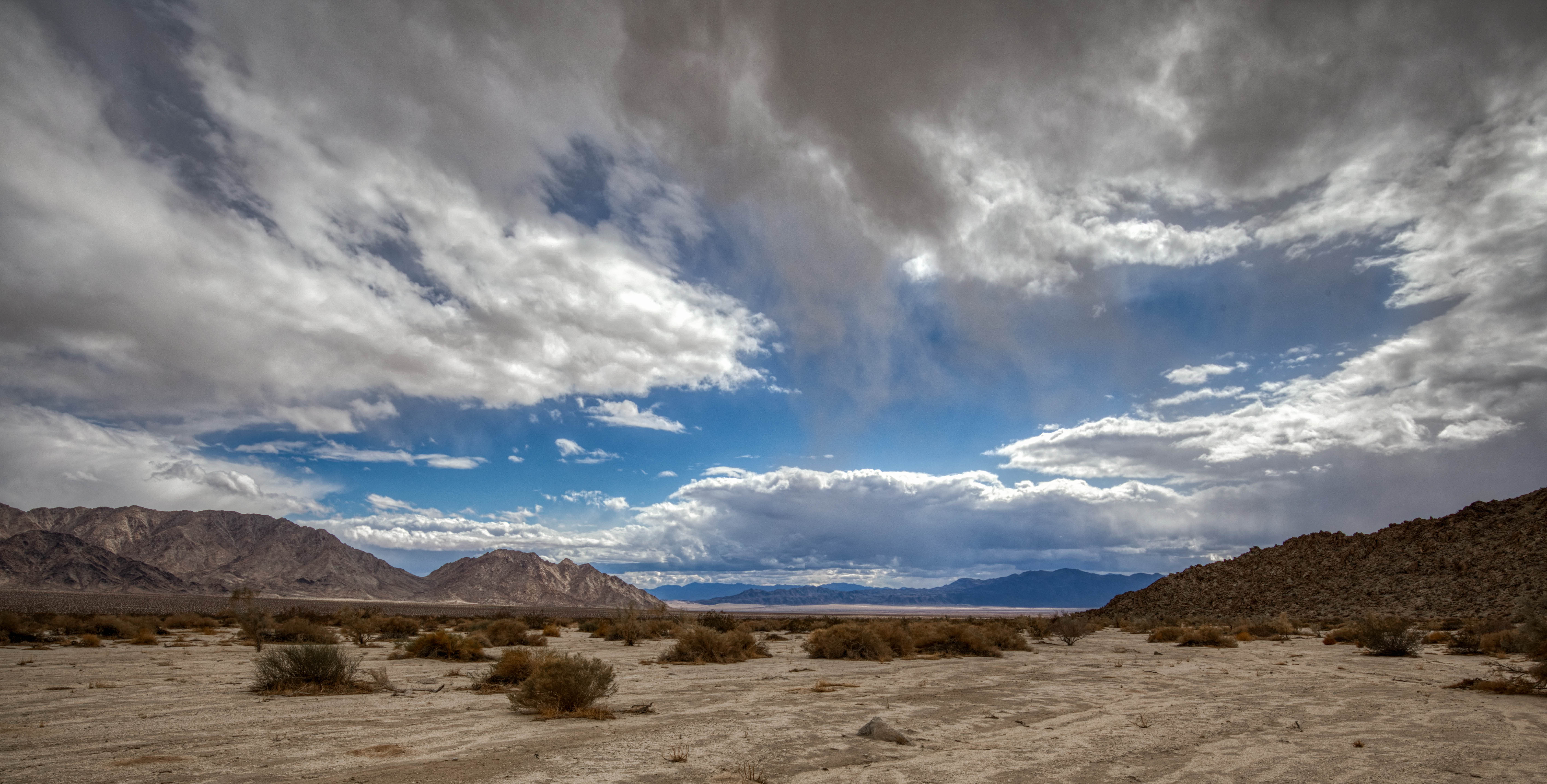
I've made the decision that I have the time and energy to go check out goal #2: The ancient shoreline. I'll be traveling E/SE (toward the Coxcombs), and I've come across this odd clearing, and wondering why nothing is growing here. Was vegetation scrapped away at some point? And what's that line on the right that looks like a game trail or native trail? I have no answers but plenty of questions!
 
What's left of someones dinner. Rabbit bones, perhaps?
 
This line of rock in the middle of the photo (above) is what I thought might be ancient shoreline when viewed on Google Earth (goal #2). Ground level view looks to me more like a natural rock formation rather than shoreline debris accumulation or erosion, but I'm no expert. Not as impressive as I was hoping for, but interesting nonetheless.
 
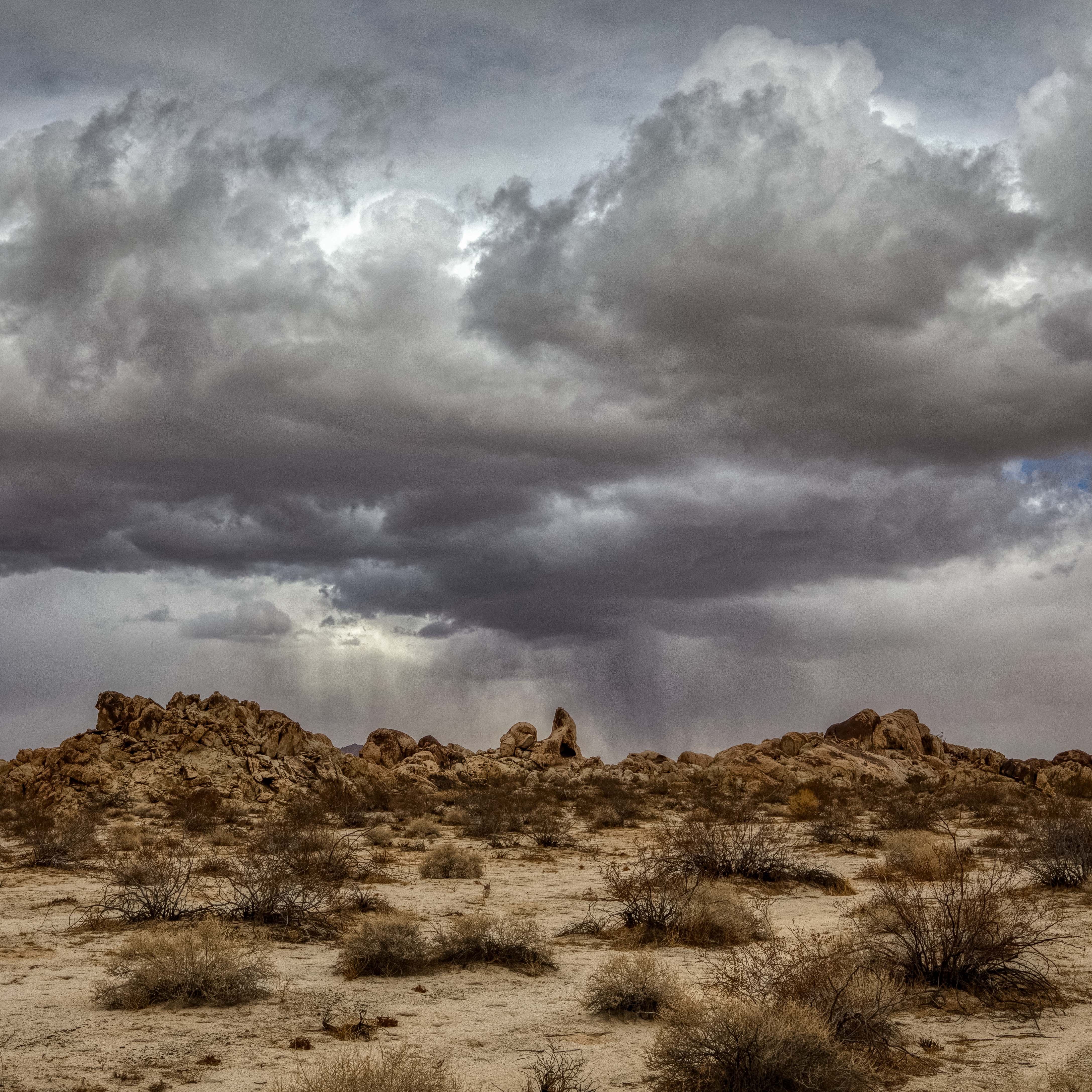
It's a barren, bleak landscape. I've decided to go a little further, following the rocks on my right to the SE, until I have a clear view of the southern end of the Coxcombs and the Pinto Basin to the south. It's been a long time since I've seen any human footprints, and this area is rarely visited.
 
Strangely eroded rock wall.
 
Early tablet prototype!
 

Snaggletooth monster!
 

Hello old friend!


I'm falling!!
 
Thanks for joining me on another adventure. No ancient shoreline, but a fascinating and remote area!
Linking with Skywatch Friday.


Thursday, July 21, 2022

Big Head Rocks

 I enjoy spending time looking at Google Earth (GE), hoping to find an interesting rock formation or unusual feature for future hikes. If you think about it, the ability to look down from a satellite hasn't been around all that long (GE came out in June of 2005). It wasn't too many years ago when all an explorer had to go by was a topo map, compass, and word of mouth. 

I was perusing GE and came across some very large boulders that reminded me of giant heads (see screen capture below). Four or five big, round boulders, lined up in a row, in an area that didn't have very many big boulders. I marked the location with a note that said "Big Head Rocks" and knew I had discovered a future hike location.
 
Earlier this year, the opportunity came to make the hike to Big Head Rocks. I reminded myself that things look totally different at ground level (vs. satellite view), and these boulders likely wouldn't turn out to be anything special. Still, I figured it's worth a look, and I would be hiking to an area I've never seen. It's impossible to hike in the desert without seeing some interesting stuff along the way!
 
On this particular day, the desert skies were extra special. I couldn't resist stopping on my drive out (very unusual for me, as I'm usually in a hurry to get started on my hike). This is Ironage Road, looking north, just steps off of Highway 62. I was crossing my fingers these clouds would stick around for my entire hike.
 
I pulled off the highway at the spot where I planned to start my hike, stepped out of the car, and took this photo (looking east on Highway 62). I hike this area all the time, but rarely do I get skies this pretty!
 
Looking north from my parked car, I could see rain on the horizon. Beautiful, but also the little yellow caution flag in my brain was raised. Rain, with the potential for flash flooding, is never to be taken lightly in the desert. 
 
I had just barely started my hike, and found myself admiring the clouds over the Coxcomb Mountains. I changed lenses to a telephoto and took this photo, then reminded myself I need to pick up the pace if I'm ever going to make it to Big Head Rocks (about 5 miles one way).
 
One more photo, looking NE at the filtered light hitting the valley floor, and I was on my way in earnest! I'll stop the narrative for a bit and just let you enjoy the views.


I followed this large, sandy wash for a while, and noticed the skies were getting seriously threatening. By definition, a desert wash is where water collects during a rain storm. They go from bone dry to a fast flowing river quickly, so I was on high alert as I continued my hike.
 
There's a side wash that looked interesting on GE that I wanted to explore on my way to Big Head Rocks. The first thing of interest was this old tortoise shell. These poor animals have a really tough life, and many of them don't make it.
 
The next thing I came across was this really interesting cave. Mostly you just find shallow alcoves, but this one is deep enough to qualify as a cave! Let's take a look inside...
 
Say "ahhh"!!
 
Looking in... kind of creepy!
 
Looking out.
 
I saw no signs that Native Americans had used this site as a shelter, but still a very interesting find!
 
A final item of interest on this little jaunt into this side wash was a beautiful arch off in the distance!
You know me and arches... I can't resist them! I would have to choose between climbing the rocks up to this beautiful arch, or continuing on to my original goal of Bighead Rocks. There wasn't time to do both, so I decided to stick with the plan: Onward to Bighead Rocks!
 
I had my telephoto lens with me, so I captured this close-up. What a beautiful arch, and another one I've never seen photographed or documented anywhere! I'm guessing not too many people have seen it, and I promised myself to return on a future hike and make the attempt to climb up to it. Since nothing jumped into my head at the time, I'm calling it "No Name Arch", but I'm looking for suggestions!
 

Continuing on my hike down the main wash, the sky was just amazing. It was one of those days you could just point your camera in any direction and get a beautiful photo. My journey in the wash was just about completed and I would be making a hard right turn after the rocky outcropping in the photo above.

Finally... there they are: Big Head Rocks! I must say, I was underwhelmed. The other rocks and boulders kind obscure the grandeur of the larger ones. Like I said, ground view and satellite view are two very different things, and you never know what you're going to get.

A closer view of The Big Heads. Interesting, but not incredible. What interested me even more was the view in the opposite direction (looking SE).

This is a view I had never seen before. I had hiked all the way from Highway 62, through the rocks, and out the other end. In the photo above, you are looking at the southern end of the Coxcomb Mountains and the northern Pinto Basin. 


I'll leave you with this photo of the southern Coxcombs and beautiful fluffy clouds in b&w. If you've stuck with me all the way to the end of this long post, I thank you! This is another one to add to my "top five hikes" list (which is much longer than 5!), and a day with some of the prettiest skies I've seen in a long time.

Linking with Skywatch Friday.
Thanks for stopping by!!
10.3 miles... 700' of elevation gain... 41 minutes to hike one mile!!??
I call that "photographers pace". I took over 200 photos on this hike.