I've hiked once to the area my friend Mitch calls "Shangri La" (read my post here), and I swore I would never do it again. It was 11 miles of the most rugged, difficult, and inhospitable terrain I've ever hiked, with an elevation gain of 1759'. About a year after that hike, Mitch tells me he thinks he found a new approach to Shangri La. There is an initial steepness, but after that, easier and shorter. The biggest thing luring us back was a beautiful arch we spotted from a distance. We agreed it would be great to hike in closer to the arch for some better quality photos. I reluctantly said yes to the hike. Roger, Mitch and I met at about 6:30AM at Rattlesnake Canyon. See the black arrow in the photo? That's our first big altitude push. In my mind, I'm thinking if I can make it up there, the rest will be relatively easy going. But that first push is very steep and covered in boulders, so it's not going to be easy.
 |
| We will be following the red line. |
 |
| Up we go! |
We come across a few areas where the rocky soil has been disturbed and smoothed out, and lots of bighorn sheep poop, so we know they are sleeping up here.
Mitch and Roger still feeling feisty as the sun crests the hillside. But keep in mind it's only 7:30AM, and we aren't even to the top of the hill yet!
Rattlesnake Canyon in Joshua Tree has these interesting boulders... hard stones with a softer rock matrix holding everything together. As the rock erodes, it leaves these small hard stones covering the ground. Roger calls them marbles. Image walking up (and at the end of our hike, down) a super-steep mountain of marbles, and you'll get the picture!
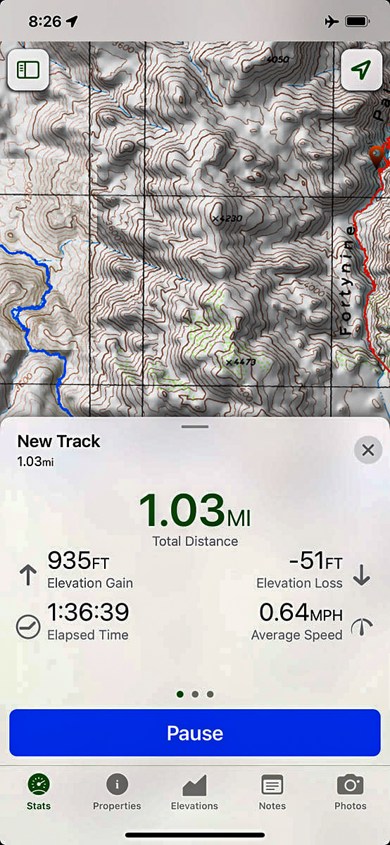
Finally up on top of the hill, the news isn't good. Going straight ahead to our destination, the hill drops off just as steep as the one we just climbed up! And then we would have to climb another hill. And another. We decide to take a longer route with less extreme elevation changes. Mitch shares a screen shot from his phone. In a little over 1.5 hours, we've gone just one mile but gained 935' in elevation. Slow & steep!
 |
| Me standing next to a very large red barrel cactus. |
I think Mitch took this one. That's Indian Cove campground and the road leading in to Rattlesnake Canyon over my shoulder.
 |
| Window framed by rocks. |
A virtual friend of mine was kind enough to alert me to the existance of an old exploded rocket from WW2. Yes, you heard that right... in Joshua Tree National Park!! So it was definitely something I wanted to track down on this hike. The first thing we came across is some debris, so we knew we were getting close.
 |
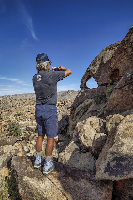
| Mitch taking a photo of what we think is the main part of the rocket. Very cool! |
My friend did some research and somehow figured out that this is a Tiny Tim air-to-ground rocket that was developed at the China Lake Naval Air Station during WW2. His best guess is that a plane test fired it into (what was then) Joshua Tree National Monument. Sounds crazy, but it's the only possible explanation. You find the strangest things in the desert. Any nearby hikers would have had the bejeebers scared out of them! |
| Rodger riding the bomb! |
Did anyone see the Dr. Strangelove movie??
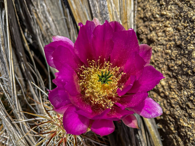 |
| Flowering cactus near the rocket. |
We came across a number of Pinyon Pine branches in the area with this mysterious red stuff all over them. We finally figured out it is likely bird poop. There's a bird called the Phainopepla (see below... internet photo) that's common to the area, and who feeds on Desert Mistletoe (see below). It appears the red mistletoe berries pass right through them! After finding the rocket, we came across this huge rock formation (I'm at the base for size perspective). I didn't see any rock art, but definitely signs that Native Americans were here long before us.
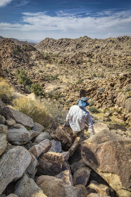
Somewhere in this area is the arch we are hoping to find. We're coming at it from a different direction, so it takes more exploring than I anticipated, but eventually... We spot it!! And it's a beauty. Now that we found it, we're hoping to get closer for some good photos. But getting up those rocks won't be easy, and I'm really starting to get fatigued.  |
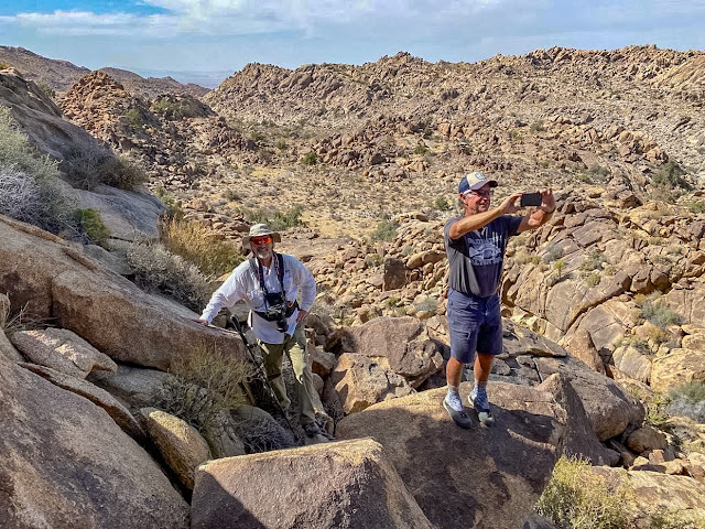
| Mitch and Roger on their way up to the arch. |
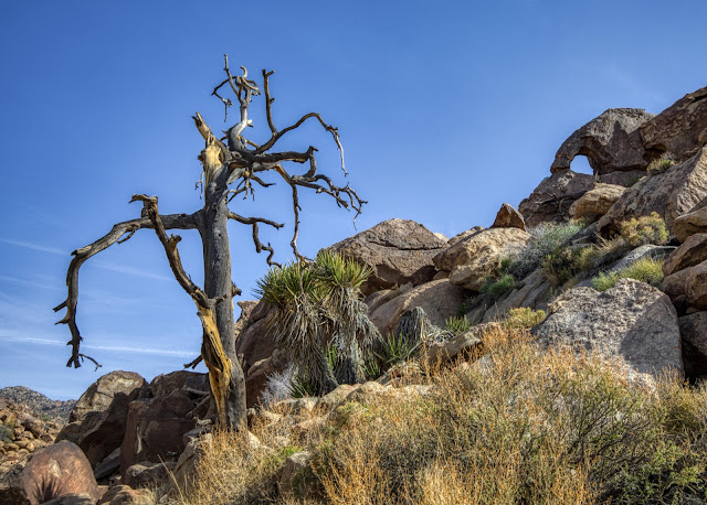 |
| One of my favorite photos from the day. |
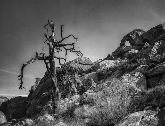 |
| It even looks good in b&w! |
 |
| Roger is very comfortable in high places. |
 |
| Time to head back down from the arch. |
 |
| Late afternoon light on a pancake prickly pear. |
 |
| Seems like all we've been doing all day is climbing over boulders! |
An ominous sign. Perhaps from a bighorn sheep?
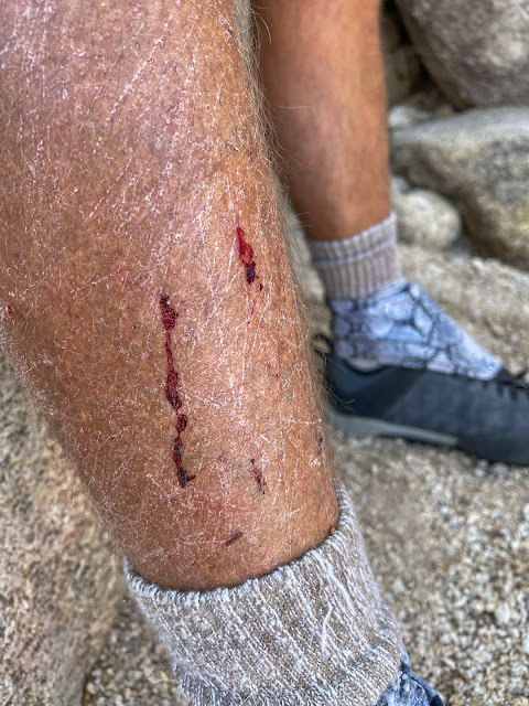 |
| Roger really should not be wearing shorts on these hikes! |
I'm truly at the end of my endurance limits. We still have to push over the top of the peak in the distance and down the other side, and I tell the guys I need a rest stop. It's been a long difficult hike on a hot day, and I'm out of water. I have a headache and feel a little nauseous (both early indicators of heat stroke). Thankfully, Mitch has extra water, but I know I'm going to have to proceed slowly and carefully if I'm going to safely make it back to the car.
We are treated to this beautiful sunset as we finish up our hike. We've been hiking down steep terrain on marble-like rocks with tired legs. It's a bad combination, and I think we all slipped (but caught our balance) at least a few times on the way down. Thank goodness for hiking poles!
I'm relieved that I completed such a challenging hike, but a little bittersweet knowing I will likely never return to Shangri La. As I age, I need to pick my hikes carefully and recognize my limitations so I can stay safe. What a wonderful adventure it's been, and a privilege, to hike into this seldom seen area!
```````````````````````````````````````````````````````
My Garmin tells me we hiked 12.0 miles. My Gaia GPS app on my phone says 11 miles. Elevation gain was 1,785'. Total hiking time was 12 hours and 41 minutes.
Thanks for joining me on this adventure, and if you stuck with me to the end, it's very much appreciated!